Position  [ Mapa
]
[ Mapa
]
The península de Santa Elena is situated to 120 Km. To the east of the Guayaquil city and to 540 Km. South –west of the Quito city.
Orign
The peninsula de Santa Elena arose by the necessity to find a rest and tranquility, projecting nowadays like a touristy place that has a holiday infrastructure and a rich variety of attractive naturals and cultures.
LA RUTA DEL SOL
 Is called ¨Ruta del Sol¨ a part of the Ecuadorian coast, edging the calms waters of the Ocean Pacific. The ¨Ruta del Sol¨ begins since the Península de Santa Elena to the Manabi’s coast and it is rich in attractive touristy including archaeologist, historical, naturals, cultures, and picturesque villages with fishers. Is called ¨Ruta del Sol¨ a part of the Ecuadorian coast, edging the calms waters of the Ocean Pacific. The ¨Ruta del Sol¨ begins since the Península de Santa Elena to the Manabi’s coast and it is rich in attractive touristy including archaeologist, historical, naturals, cultures, and picturesque villages with fishers.
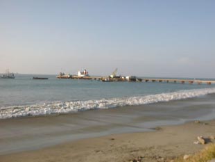
The start is situated on ¨La Libertad¨, commercial place and banking very important of the península. The next step is ¨Santa Elena¨ where exits the famous archaeology museum of "Los Amantes de Sumpa" and of Real Alto, the ¨Parque Ecológico¨ and the famous ¨baños de San Vicente¨(fountains of thermals waters and volcanic mud, excellent for the health).
A few minutes from the Santa Elena city, we can found the museum of ¨Real Alto¨ , which is part of the cultural tradition of the ¨valle de Chanduy¨.
Another place for visiting inside the ¨Ruta del Sol¨ is the place called ¨ Baños de San Vicente¨ , with his pools of thermal water and the massages with volcanic mud, recognized by its medicinal importance.
In Santa Elena we can found also the museum of the ¨ Amantes de Sumpa¨ , with the archaeology exposition aged 9 mil years b.C.., it have been one of the most complete and autodidactic that still exist.
Following in north direction, from the Santa Elena city, you arise to La Libertad , a beautiful city with a very commercial active life, filled of banks and business. IN the Way to Salinas we found the mall ¨ La Península ¨, incredible place to go shopping. Arriving to Salinas , the biggest watering-place of commercial development and urbanity, you can take a walk by the beautiful ¨Malecon of Salinas¨ (a dike in the sand) and the beach, Also you can visit the artesian market and the night movement (parties, blazes) and diurnal that also exist; in the same way exist Mar Bravo y Punta Carnero , place wher you can observe birds and surfing.
Another unique place is situated in Ballenita is the ¨Galería Náutica y Mirador¨ from the hostelry Farallón Dillon , which shows collection parts.
Continuing to the North, by beautiful passages, big beaches and picturesque villages in the Km. 42 are situated Valdivia, who has the museum archaeology-artesian and an interesting aquarium.
The gipsy town of Montañita is the next in the way, and incredible place for practice surfing and camping. After of Montañita is the beginning of the splendid mounting range ¨ cordillera Chongón-Colonche¨ , called "Los cinco cerros' ; in the middle of the splendid mounting range is the Atamari, where you can observe a variety of bird of the coast.
On the bottom of the mounting range, a 15 KM is the ¨ Parque Nacional Machalilla¨ , where you can enjoy de walks observing a lot of kinds of birds, archaeologies places and virginals beaches, like ¨Los Frailes¨.
In Puerto López , you can take a boat for observing whales and you can visit a island called ¨ Isla de la Plata ¨ , where you can find flora and fauna similarity to the Galápagos islands .
|